


What does it mean to coexist with our ecosystem?
Conducting fieldwork in Morinomiya
Urban development is underway in the Morinomiya neighborhood at the eastern edge of Osaka Castle (near JR/Osaka Metro Morinomiya Station), with the aim of breaking ground in spring 2028. With plans for both a new railway station and Osaka Metropolitan University’s Morinomiya campus, the area will be developed in cooperation with the university and local community. In light of this, the Urban Renaissance Agency (UR), which has a former branch office and manages UR rental housing units in the area, has started a new initiative. By finding a new use for the ground floor of its disused office building, UR hopes to forge new relationships within the community and generate new value.
As a preliminary trial, UR and SPCS co-hosted a fieldwork excursion in Morinomiya with people from local government, companies, and universities involved in urban development in the area. Participants considered how Morinomiya’s natural and urban environments interact, as well as how development could bring out the neighborhood’s charm. The session included a neighborhood walk and a series of talks held on the first floor of the former UR branch office, which currently sits empty.
Guest speakers included Brian McGrath and Danai Thaitakoo, two practitioners of urban ecological design, and Atsuro Morita, a cultural anthropologist at Osaka University. The program was designed in collaboration with Mariko Sugita, a member of the urbanism collective for Cities.
In recent years, the climate crisis has seen devastating floods and skyrocketing temperatures even in urban areas, which has spurred the growth of ecological approaches to urban design and architecture—approaches that emphasize coexistence with local ecosystems and environments. Could the Morinomiya initiative be shared around the world? In this article, we will present insights and prospects for the future of city planning from our fieldwork.
Text: Chiaki Ogura
Translation: Gina Goosby
Photography: Ryo Matsumoto
Editorial: Nami Urano (SPCS)
An introduction to Morinomiya and Mizube

The Morinomiya/Mizube (mee-zoo-beh, literally “waterside”) area, the target for this development project, is in the center of Osaka’s Minami-Kita (south-north) urban center. To its east is Mt. Ikoma, and to its north is the Yodogawa River. Osaka Castle Park lies along the district’s western edge, and farther in that direction lie the Ajigawa and Kizugawa Rivers. All told, the area has an abundance of natural beauty.
Did you know that the name “Morinomiya” comes from the area’s Kasasagi Morinomiya Shrine? The shrine was built by Prince Shotoku in the sixth century, and earned its name because magpies (kasasagi) were raised in the surrounding forest (mori) to be offered at the shrine (miya). Over time, the shrine’s name was shortened to just Morinomiya and used to refer to the surrounding area.
It is in this historic neighborhood that the new Osaka Metropolitan University campus and a new metro station will open in the coming years. Development is already being set in motion. Morinomiya is already connected via transportation to the Kansai Expo site and major hubs like eastern Osaka’s Gakkentoshi. We have a unique opportunity to dig deep into this neighborhood before it changes even further.

Let’s look briefly at the history of the Morinomiya area. Six to seven thousand years ago, the region was a seabed; gradually, sandbars and beaches spread as the water receded, and around the fifth century AD, land was reclaimed to make the Osaka Plain. That’s right, Osaka was originally a sea! The area Osaka Castle now stands, in addition to Morinomiya to its east, were on the forested Kamimachi Plateau.
Osaka — and, by extension, Morinomiya — is both rich with water resources and vulnerable to water. When Osaka Castle was constructed, many of the waterways now commonly seen around the city were built to manage city wastewater and sewage. This history speaks to Osaka’s close relationship with water over the centuries.

After the 1868 Meiji Restoration, Morinomiya became the site of military training grounds and artillery factories. In fact, factories of various trades became concentrated in the neighborhood, making it a driving force in Japan’s early modern industrial development; many technological innovations of the time were discovered here. In later decades, the government sold the land, and the area came to house railways and UR rental housing. Today, there’s also a Nakahama sewage treatment plant in the area, which uses a high-efficiency membrane bioreactor to purify wastewater. Additionally, environmental efforts like flood control are proceeding steadily.


Perspectives on ecological urbanism
With Morinomiya’s rich ecological history, community development moving forward should cultivate a place-based culture that centers the land and its history. To explore this direction, we invited three ecological urbanism practitioners to share their work and explore possible futures through a walk in Morinomiya.

The first speaker was Atsuro Morita, an associate professor of anthropology at Osaka University’s Graduate School of Human Sciences and director of Ethnography Lab Osaka. Dr. Morita specializes in using ethnographic research methods to investigate the relationship between technology, society, and the environment. Early in his career, he conducted fieldwork in Thailand, which led to collaborations with civil engineering and hydrology researchers to research flood control systems in Bangkok. Currently, Dr. Morita engages with interdisciplinary urban design research based on organic relationships among our lifestyles, environment, and infrastructure.
“Today’s cities are not just collections of buildings, but can be thought of as ecosystems with flora and fauna and atmospheric circulation. Constructed objects like buildings interact with the ecosystem and organisms like vegetation, often through the flow of water. The role of ecologists in urban design is becoming increasingly important — you could say the baton of city planning is passing from architects to ecologists,” says Morita. In his presentation, he explored cities as ecosystems through examples such as green infrastructure.

The next speaker was Brian McGrath, a professor of urban design at Parsons School of Design at The New School who has long worked at the intersection of architecture, the environment, and social justice. He served as a principal investigator for the Baltimore Ecosystem Study, one of the first research projects to study cities from an ecological perspective. The study aimed to characterize the ecological interactions of patches of the urban ecosystem from roads and architecture to vegetation, with the hope of uncovering yet-unseen solutions to social and environmental issues.
In his talk, Professor McGrath praised Morinomiya for its abundance of greenery and water, but argued that they were inaccessible. Ecosystems have a certain porosity to them, allowing organisms and resources to move freely. In a similar fashion, urban development in Morinomiya should emphasize what porosity already exists and prioritize access to the area’s natural resources.
Additionally, Professor McGrath introduced the concept of Waterscape Urbanism, which reimagines cities as watersheds—water is accessed everywhere, not just at the river’s edge. By understanding the movement of water, McGrath said, urban activities can also be more thoroughly analyzed and designed from both ecological and sociological perspectives.

The final speaker was Dr. Danai Thaitakoo, a landscape architect and landscape ecologist at King Mongkut’s University of Technology Thonburi and landscape architect at Chulalongkorn University’s Department of Landscape Architecture. A veteran in the field of landscape architecture, Thaitakoo has studied Thailand’s traditional water-centric urban landscapes and how they are changing with modernization. He spoke about how Bangkok has been shaped by major floods due to its dry and rainy season cycles and frequent flooding. By applying anthropological, geological, and ecological perspectives to his research of traditional Thai irrigation systems and water management practices, Thaidakoo delves deep into the relationship between traditional Thai architecture, urban planning, and the environment.
In his talk, Thaidakoo proposed designing landscapes that control flooding by bringing water closer, rather than keeping it away. As a case study, he introduced the “From Gray to Green” project, a plaza and parking space renewal project at Chulalongkorn University in Bangkok which he worked on. This project aimed to replace the space’s concrete with materials and a landscape that take into account Bangkok’s topography, environment, ecosystem, and traditional wisdom. The resulting urban design transforms with the seasons and weather, becoming a garden and community space in dry weather and a pond in rainy weather.

An hour of fieldwork in Morinomiya with for Cities
In the second half of the program, participants went out to conduct fieldwork in the area east of Osaka Castle, armed with kits designed by Mariko Sugita from for Cities. for Cities is an urban experience design studio that conducts fieldwork in cities across the globe to research urbanism from a “soft” perspective—through everyday life and experiences.

The CITY SURVEY SET prepared by Sugita contained eight worksheets, from which participants chose ones they were interested in. While they were walking around, they recorded observations of materials and resources, behavior of passers-by, and non-human elements. They were also encouraged to take note of smells, scents, and sounds to fully engage their senses in experiencing the city.

Participants split into three teams and ventured out into Morinomiya. Throughout their guided walks, each team recorded what they found, including a rail yard, riverside, bridge, sewage treatment plant, large water reservoir, and UR housing complex.
For instance, some participants discovered design in the city through taking rubbings of the texture of wire mesh. Others noted the variety of birds in the river, or the smell of a sewage treatment plant as they passed by. Through this exercise, participants were able to discover and reaffirm parts of the environment they otherwise would have overlooked.


A sense of place
Everyone found something profound in their fieldwork. One person noted that the main street was a place for racing cars, with no room for rest. Each observation was a discovery, and as people shared, the group’s energy and inspiration rose.
One participant commented, “The streets have grown and become places for movement only. Maybe we need spaces to linger. Urban planning tends to be conducted like a puzzle seen from a bird’s eye view, but it should be brought back to eye level. It would be good if we could design places from the bottom up, from the viewpoint of lived experiences, instead of from a macro perspective. Even by just changing our own lifestyles, I think we can create ecologically friendly places.”


McGrath focused on mental mapping, a method developed in the U.S. in the 1960s wherein a person incorporates their own consciousness and senses into a map, instead of looking only at an actual map.
“When I was walking along the lifeless main street, it felt endless. But once I crossed the bridge where you can see Osaka Castle and entered the residential area with the UR apartments, I realized that sense of place is where you are. Even your walking route has an influence on the city,” he said. “Although we’re in the planning phase now, when we progress to constructing hotels and shopping malls, or talking specifically about funding, we must remember the simple ideas we have now and be able to advocate for them.” He suggested that it may be necessary to incorporate emotions into urban design with techniques like mental mapping.

Is controlling nature dangerous?
Thaitakoo pointed out the wall separating the river from the Morinomiya neighborhood.
“What if, for example, the wall could be shifted? If that high wall were moved further inland, you can create a space connected to the river where the water level changes with the seasons. The scenery would be nicer, and it could even be a beach area in summer,” he explained.
“Now is the time to rethink the relationship between water and people. Originally, rivers mitigated disasters — now, they themselves have become a threat. Because we have thrown up walls between rivers and people, they’ve grown apart, and the threat grows. It’s scary to think that by isolating ourselves, we become unable to respond to our world. Free the river!
“Unlike in the past, we know much more about disasters and how to prevent them; we understand the causes of flooding. Instead of separating water and people, they should be closer together. By reintroducing water to urban design, that threat and fear of the water will disappear,” Thaitakoo added.
Expectations will only grow for development initiatives in this historical neighborhood by the water. Thaitakoo’s proposal to integrate water into infrastructure for better flood mitigation is well-suited to Morinomiya, which has already been the site of several flood control and environmental initiatives. Indeed, a town developed to bring people and the river together could become a foresighted case study for ecological cities of the future.

Revealing Morinomiya’s unique power of place through ecology
McGrath and Thaidakoo said that as the ecological character of the area is discovered, the roots of its culture and economy become obvious. Furthermore, they highlighted the importance of implementing small-scale community initiatives rooted in local ecology.
From the ancient seas and wetlands that once comprised Osaka, Morinomiya arose as a shrine grove blessed with natural beauty and long used for flood protection. Now, we have a unique opportunity to work together with local communities to shine a light on this storied area’s hidden appeal. Not only will development contribute to disaster mitigation, but we may also imagine a city that can’t be found anywhere else in the world.
We will continue to engage with new urban ecosystems through interdisciplinary activities, sharing our findings along the way. If you are interested in participating, please contact us.

References
Publications related to this event’s guest speakers and fieldwork:
- About community development in the area east of Osaka Castle” (Japanese only)
- Resilience in Ecology and Urban Design(Brian McGrath, 2013)
- The Architecture of the City(Aldo Rossi, 1984)
- Patch Atlas: Integrating Design Practices and Ecological Knowledge for Cities as Complex Systems(Victoria J. Marshall, Mary L. Cadenasso, Brian P. McGrath, Steward T. A. Pickett, 2020)
- Bangkok liquid perception: waterscape urbanism in the Chao Phraya river delta and implications to climate change adaptation(Danai Thaitakoo and Brian McGrath, 2010)
- Multispecies Infrastructure: Infrastructural Inversion and Involutionary Entanglements in the Chao Phraya Delta, Thailand(Atsuro Morita, 2017)

About SPCS

SPCS (Species) is a community that explores designs and forms of expression that collaborate with nature, ecological systems, and non-human entities by actively confronting their uncontrollable factors through prototyping.
Our interdisciplinary approach integrates natural sciences, art, design, and engineering to discover new ways of knowing the natural world.
Recommended
-
2026.01.20
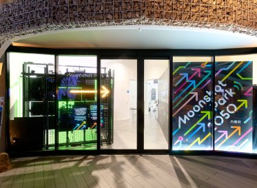
From 2050 to now: Transforming future research into immersive experiences at The Moonshot Park at Expo 2025 Osaka
-

2025.11.18
From scaffolding rentals to a value-driven company: A six-year transformation across 15 projects
-
2025.10.01
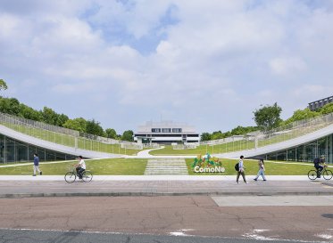
Loftwork contributes to the new ComoNe innovation space in the Tokai Region
-

2025.02.04
Exploring Creative Iterators in Japan’s Local Regions From Interviews to Editing in "AAA City Art & Lifestyle Journal Vol.8" Cover Story
-

2025.01.24
DRIVE MYSELF PROJECT: Co-Creating Future Mobility with NISSAN and the Next Generation
-

2024.12.05
Future Dynamic Program 2024: Sustainability in Action